Avatar

David Frantz

Assistant Professor

Trier University

I am fascinated by the current posssibilities Earth Observation offers. Raised as an environmental scientist with a strong background in remote sensing and geoinformatics, my research concentrates on how to “go from data to information” tailored for a wide range of environmentally centered research and monitoring needs. This particularly includes the preprocessing of operational EO data archives to analysis ready data, their management in data cubes, subsequent processing via data reduction, interpolation, time series analysis, and data integration with complementary data sources, as well as data analysis based on statistics and machine learning.

I fully support open science. Thus, I am publishing all my software and methods as open source code: FORCE.

I am Assistant Professor for Geoinformatics - Spatial Data Science at Trier University’s Earth Observation and Climate Processes department, where I am focusing on Earth Observation from a data-centric perspective.

Interests

  • Earth Observation
  • Data Science
  • Analysis Ready Data
  • Big Data Processing Workflows

Education

  • PhD in Remote Sensing, 2017

    Trier University, Trier, Germany

  • Diploma (MSc) in Applied Environmenal Sciences, 2012

    Trier University, Trier, Germany

Professional Experience


Assistant Professor

Geoinformatics - Spatial Data Science, Trier University

Sep 2021 – Present Trier, Germany


PostDoc

Earth Observation Lab, Humboldt-Universität zu Berlin

Nov 2017 – Aug 2021 Berlin, Germany


PhD

Environmental Remote Sening & Geoinformatics, Trier University

Jun 2013 – Oct 2017 Trier, Germany

Software

FORCE

… is an all-in-one solution for the mass-processing and analysis of medium-resolution satellite image archives for large area + time series applications.

Publications

Publications

For an up-to-date list of my publications, see https://geoinformatics.gitlab-pages.uni-trier.de/publications/Frantz.html

Presentations

.js-id-2022

National-scale information extraction using harmonized Landsat and Sentinel-2 data cubes with FORCE

David Frantz, … @ 4. Symposium zur angewandten Satellitenerdbeobachtung, Bonn, 26-28 June 2023

Analysis Ready Fernerkundungsdaten erzeugen mit FORCE

David Frantz, Stefan Ernst, Benjamin Jakimow, Patrick Hostert @ FOSSGIS, Berlin, 16 March 2023

Die kontinuierliche Bereitstellung von Waldstruktur- und Waldzustandsinformationen auf der Basis von Sentinel-Daten

Joachim Hill, Henning Buddenbaum, Andreas Hill, David Frantz @ Copernicus Netzwerkbüro Wald, Online, 17 January 2023

Processing of satellite data - Standardization

David Frantz @ Tree Species Project Workshop, Göttingen, Germany, 27-28 September 2022

The workflow perspective in remote sensing - scaling RS workflows

David Frantz @ Interdisciplinary Workshop on Workflows for Large-Scale Remote Sensing Data Analyses, Berlin, Germany, 26 September 2022

The FORCE DataCube on CODE-DE

David Frantz @ DataCubes auf CODE-DE, Webinar, 28 April 2022

ACIX II – Land: the second implementation of the Atmospheric Correction Inter-comparison eXercise over Land

Georgia Doxani, Eric F. Vermote, Jean-Claude Roger, Sergii Skakun, Ferran Gascon, Alan Collison, Liesbeth Dekeukelaere, Camille …

CMIX: Cloud Mask Intercomparison eXercise

Sergii Skakun, Jan Wevers, Carsten Brockmann, Georgia Doxani, Matej Aleksandrov, Matej Batič, David Frantz, Ferran Gascon Roca, Luis …

Copernicus enabling national monitoring across land systems

Patrick Hostert, Lukas Blickensdörfer, Stefan Erasmi, David Frantz, Helmut Haberl, Claas Nendel, Dirk Pflugmacher, Franz Schug, Marcel …

High-resolution mapping of 33 years of material stock and population growth in Germany using Earth Observation data

Franz Schug, David Frantz, Dominik Wiedenhofer, Helmut Haberl, Doris Virág, Sebastian van der Linden, Patrick Hostert @ Living Planet …

Landsat based analyses of major land use and cover transformations after Spain’s accession to the EU

Marion Stellmes, Achim Röder, Ruth Sonnenschein, David Frantz @ Living Planet Symposium, Bonn, 23-27 May 2022

Mapping Luxembourg’s soils with Sentinel-2

Andreas Krein, Max Gerhards, Henning Buddenbaum, Thomas Udelhoven, David Frantz @ Living Planet Symposium, Bonn, 23-27 May 2022

Multi-annual forest fraction mapping over northern Germany using Sentinel-2 spectral temporal metrics

Dong Pham, Fabian Thiel, Franz Schug, David Frantz, Sebastian van der Linden @ Living Planet Symposium, Bonn, 23-27 May 2022

National-scale mapping of building height using Sentinel-1 and Sentinel-2 time series

David Frantz, Franz Schug, Patrick Hostert @ Living Planet Symposium, Bonn, 23-27 May 2022

Offline! Visualization and labeling of multi-sensor time series in the field: the EO Time Series Viewer

Benjamin Jakimow, Sebastian van der Linden, Fabian Thiel, David Frantz, Patrick Hostert @ Living Planet Symposium, Bonn, 23-27 May 2022

The FORCE DataCube on CODE-DE

David Frantz @ Copernicus Workshop, Landesbetrieb Landesvermessung und Geobasisinformation des LGLN, Hannover, 23 March 2022, Online

FORCE on Nextflow: Scalable Analysis of Earth Observation data on Commodity Clusters

Fabian Lehmann, David Frantz, Sören Becker, Ulf Leser, Patrick Hostert @ 1st workshop on Complex Data Challenges in Earth Observation …

Why using High-Resolution Earth Observation imagery for National-Scale Bottom-Up Estimation of Material Stocks?

Franz Schug, David Frantz, Dominik Wiedenhofer, Doris Virág, André Baumgart, Helmut Haberl, Patrick Hostert @ International Industrial …

FORCE - from large-scale EO data to information. An overview of functionality and applications

David Frantz @ Remote Sensing Lecture Day, Eidgenössischen Forschungsanstalt für Wald, Schnee und Landschaft (WSL), 2 June 2021, Online

The weight of nations - high resolution material stock mapping on national scales

David Frantz, Franz Schug, Dominik Wiedenhofer, Doris Virág, André Baumgart, Sebastian van der Linden, Helmut Haberl, Patrick Hostert @ …

The weight of nations - national-scale material stock maps based on Sentinel-1+2, OSM, and material intensity factors

David Frantz, Franz Schug, Dominik Wiedenhofer, Doris Virág, André Baumgart, Sebastian van der Linden, Helmut Haberl, Patrick Hostert @ …

Mapping Settlement And Vegetation Continuous Fields At National Scale In A Temperate Environment Using Sentinel-2

Franz Schug, David Frantz, Akpona Okujeni, Sebastian van der Linden, Patrick Hostert @ EARSeL Joint Workshop 2021 - EO for sustainable …

A novel approach for mapping material stocks of buildings and infrastructure from remote-sensing data at the national scale and beyond

Dominik Wiedenhofer, Doris Virág, Franz Schug, David Frantz, Sebastian van der Linden, Patrick Hostert, Helmut Haberl @ EcoBalance …

Atmosphärenkorrektur von Landsat und Sentinel-2 Daten mit FORCE

David Frantz @ Copernicus Data and Exploitation Platform - DE (CODE-DE) - Online Schulung ‘Vordefinierte Prozessoren’, 25 …

FORCE – Analysis Ready Data and Beyond

David Frantz @ GI-Forum WWU Münster, 26 January 2021, Online

FORCE – Landsat + Sentinel-2 ARD and Beyond

David Frantz @ ARD20 Satellite Data Interoperability Workshop, 2-6 November 2020, Online

Mowing detection based on Sentinel-1 and Sentinel-2 data

Marcel Schwieder, Maximilian Wesemeyer, David Frantz, David Loibl, Kira Pfoch, Patrick Hostert @ Innovation Days 2020, 20-21 October …

Using multi-temporal Sentinel-2 data to predict chemical properties of the organic surface layer of forest soils

Carina Becker, David Frantz, Rainer Petzold, Karsten Schmidt, Thorsten Behrens, Thomas Scholten @ EGU General Assembly, 4-8 May 2020, …

Abschätzung der Grünlandnutzungsintensität aus integrierten Sentinel-1 und Sentinel-2 Zeitreihen

Marcel Schwieder, David Frantz, David Loibl, Kira Pfoch, Patrick Hostert @ 40. Wissenschaftlich-Technische Jahrestagung der DGPF, 4-6 …

Analysis-Ready-Data für die Ableitung von Grünlandinformationen in Deutschland

Marcel Schwieder, David Frantz, Kira Pfoch, Patrick Hostert @ Neue Perspektiven der Erdbeobachtung - 2. Symposium zur angewandten …

Large-scale land monitoring at HUB with Landsat and Sentinel-2

David Frantz, Dirk Pflugmacher, Patrick Griffiths, Franz Schug, Patrick Hostert @ EODC Workshop - Sentinel Data Cubes for Large-Scale …

FORCE v. 2.0 – Analysis Ready Data and beyond

David Frantz, Patrick Hostert @ ESA Living Planet Symposium, 13-17 May 2019, Milan, Italy

Grassland Use Intensity Metrics from Sentinel-1 and Sentinel-2 Data

Marcel Schwieder, David Frantz, Patrick Griffiths, Kira Pfoch, Holger Lilienthal, Patrick Hostert @ ESA Living Planet Symposium, 13-17 …

Integrated Landsat/Sentinel-2 data and regression-based unmixing for large area fraction mapping of vegetation types across California’s ecoregions

Akpona Okujeni, Sam Cooper, Clemens Jaenicke, David Frantz, Patrick Hostert, Sebastian van der Linden @ ESA Living Planet Symposium, …

Land Use 2.0: how dense time series and phenometrics have improved the monitoring of long-term vegetation dynamics in Mediterranean rangelands

David Frantz, Patrick Hostert, Stefan Ernst, Philippe Rufin, Achim Röder, Sebastian van der Linden @ ESA Living Planet Symposium, 13-17 …

Mapping Olive Tree Cover Using Land Surface Phenology Derived From Sentinel-2A/B Time Series

Philippe Rufin, David Frantz, Henrieke Dierkes, Dirk Pflugmacher, Achim Röder, Patrick Hostert @ ESA Living Planet Symposium, 13-17 May …

Multi-annual Phenology Metrics At Landsat Scale In Data-Sparse Areas

Marion Stellmes, David Frantz, Achim Röder @ ESA Living Planet Symposium, 13-17 May 2019, Milan, Italy

Parallax based Cloud Detection for Sentinel-2 Analysis Ready Data Generation

David Frantz, Erik Haß, Andreas Uhl, Johannes Stoffels, Joachim Hill @ ESA Living Planet Symposium, 13-17 May 2019, Milan, Italy

Sentinel-2 and Machine Learning Regression for Built-up and Urban Green Fraction Mapping Across European Settlements

Franz Schug, David Frantz, Akpona Okujeni, Sebastian van der Linden, Patrick Hostert @ ESA Living Planet Symposium, 13-17 May 2019, …

Wall-to-wall material stock mapping – from satellite data to material stock modeling

Franz Schug, David Frantz, Akpona Okujeni, Sebastian van der Linden, Patrick Hostert @ Global Land Programme (GLP) - 4th Open Science …

Large-area land-cover and land-use change mapping in the Caucasus Mountains using topographically corrected multi-temporal Landsat composites

Johanna Buchner, He Yin, David Frantz, Benjamin Bleyhl, Tobias Kuemmerle, Tamar Bakuradze, Anna Komarova, A. Rizayeva, Hovik Sayadyan, …

FORCE - Analysis Ready Data and beyond

David Frantz, Patrick Hostert @ Dreiländertagung OVG-DGPF-SGPF, 20-22 February 2019, Vienna, Austria

Generating Analysis Ready Data from Satellite Image Archives

David Frantz @ Wissensmanagement in der Bioinformatik Colloquium, Humboldt-Universität zu Berlin, 11 January 2019, Berlin, Germany

Evaluation of topographic correction on forest mapping using Landsat imagery

He Yin, Bin Tan, David Frantz, Volker Radeloff @ American Geophysical Union (AGU) Fall Meeting, 10-14 December 2018, Washington D.C., …

Sentinel4GRIPS: Copernicus als Baustein der Forstverwaltung

Joachim Hill, Sebastian Mader, David Frantz, Johannes Stoffels, Joachim Langshausen, Jürgen Dietz, Christoph Averdung, Jens Göpfert @ …

An evaluation of urban area mapping with Sentinel-2 data and machine learning-based regression at different spatial resolutions

Sebastian van der Linden, Akpona Okujeni, Franz Schug, David Frantz, Patrick Hostert @ 5th Joint Workshop of EARSeL SIG Urban Remote …

Fernerkundliche Analysen in Zeiten von Copernicus: Neue Möglichkeiten langer und dichter Zeitreihen

Patrick Hostert, David Frantz, Patrick Griffiths, Kira Pfoch, Marcel Schwieder @ Bundesamt für Naturschutz, 18 September 2018, Berlin, …

Land Use 2.0: the role of dense time series and phenometrics

David Frantz, Patrick Hostert, Dirk Pflugmacher, Sebastian van der Linden, Matthias Baumann, Tobias Kuemmerle, Achim Röder, Patrick …

Topographic Correction of Landsat imagery in the Caucasus Mountains

Volker Radeloff, He Yin, Bin Tan, David Frantz, Johanna Buchner @ Landsat Science Team Meeting, 8-10 August 2018, Boulder, CO, USA

Assessment Of Transformation Processes In Dry Tropical Forests Using The Full Landsat Archive And Enhanced Information Products

Achim Röder, David Frantz, Marion Stellmes, Anne Schneibel, Joachim Hill @ 3rd joint EARSeL LULC & NASA LCLUC Workshop, 9-12 July, …

Crete’s grazing history – the perspective from space

Patrick Hostert, David Frantz, Philippe Rufin, Stefan Ernst, Henrieke Dierkes, Sebastian van der Linden, Achim Röder @ 3rd joint EARSeL …

Land cover mapping with multi-temporal Sentinel-2 data in mountainous landscapes

Katarzyna Ostapowicz, Ewa Grabska, David Frantz, Robert Pazur @ 3rd joint EARSeL LULC & NASA LCLUC Workshop, 9-12 July, Chania, …

Landsat time-series for mapping agricultural management at the national scale in Turkey

Philippe Rufin, David Frantz, Andreas Rabe, Patrick Hostert @ 3rd joint EARSeL LULC & NASA LCLUC Workshop, 9-12 July, Chania, …

Mapping spatial pattern of forest stands species composition with Sentinel-2 and forest inventory data in the Polish Carpathians

Ewa Grabska, David Frantz, Katarzyna Ostapowicz @ 3rd joint EARSeL LULC & NASA LCLUC Workshop, 9-12 July, Chania, Greece

Multi-annual Phenology Metrics At Landsat Scale In Data-Sparse Areas

Marion Stellmes, David Frantz, Achim Röder @ 3rd joint EARSeL LULC & NASA LCLUC Workshop, 9-12 July, Chania, Greece

Phenological Characterization of Vegetated Land Surfaces Using Integrated Landsat 7 ETM+, Landsat 8 OLI and Sentinel-2 A/B MSI Time Series

David Frantz, Sebastian Mader, Marcel Schwieder, Patrick Hostert @ 3rd joint EARSeL LULC & NASA LCLUC Workshop, 9-12 July, Chania, …

Understanding The Dynamics Of The Fire Regime And Its Impacts On Ecosystems In Southern Africa

Marion Stellmes, Manfred Finckh, David Frantz, Rasmus Revermann, Achim Röder @ 38th Annual EARSeL Symposium, 9-12 July 2018, Chania, …

On the potential of the synergistic use of multisensor Landsat 7 ETM+, Landsat 8 OLI and Sentinel-2 A/B MSI time series

David Frantz, Sebastian Mader, Patrick Hostert @ ESA LPVE 2018, 27 February – 1 March 2018, Frascati, Italy

Synergies between future Landsat and European satellite missions: From land cover to land use

Patrick Hostert, Dirk Pflugmacher, Patrick Griffiths, David Frantz, Sebastian van der Linden, Matthias Baumann, Tobias Kuemmerle, Achim …

Integrating Phenological Information for Pixel-Based Compositing - Generation of Multi-Seasonal Composites Using MODIS and Landsat Image Archives

David Frantz, Achim Röder, Marion Stellmes, Joachim Hill @ MultiTemp 2017, 27-29 June 2017, Bruges, Belgium

Multi-annual Phenology Metrics at Landsat Scale Using Spatially Improved Land Surface Phenology to Support Monitoring of the Status and Change of Land Cover in Central Angola

Marion Stellmes, David Frantz, Anne Schneibel, Achim Röder @ MultiTemp 2017, 27-29 June, Bruges, Belgium

An Operational Processing Chain for Medium Resolution Earth Observation Data to Establish Datacubes for Environmental Monitoring In Southern Africa

Achim Röder, David Frantz, Anne Schneibel, Marion Stellmes, Joachim Hill @ The 37th International Symposium on Remote Sensing of …

FORCE - Framework for Operational Radiometric Correction for Environmental Monitoring

David Frantz Joachim Hill @ ACIX: CEOS-WGCV Atmospheric Correction Inter-comparison Exercise

Sentinel4GRIPS: Assimilation von Erdbeobachtungsdaten in forstliche Inventur- und Planungssysteme

Joachim Langshausen, Joachim Hill, Christoph Averdung, David Frantz, Sebastian Mader, Johannes Stoffels, Jürgen Dietz, Jens Göpfert @ …

Aufbereitung von Satellitenbildarchiven zur Charakterisierung von Waldsystemen

David Frantz, Erik Haß, Joachim Hill @ Einsatzmöglichkeiten von Sentinel-Daten aus dem Erdbeobachtungsprogramm Copernicus, 8 March …

Sentinel4GRIPS - Aufbereitung von Satellitenbildarchiven zur Charakterisierung von Waldsystemen

David Frantz, Erik Haß, Joachim Hill @ Precision Forestry 2016: Beiträge aus Fernerkundung und Geoinformatik, 21 December 2016, Trier, …

Integration von Sentinel-2 Daten in die automatisierte Level-2 Prozessierung von Erdbeobachtungsdaten

David Frantz, Erik Haß, Joachim Hill @ Veränderungserkennung mittels Fernerkundungsdaten, 8-9 November 2016, Koblenz, Germany

Understanding the fire regime of Southern Africa and its impacts on ecosystems

Marion Stellmes, David Frantz, Manfred Finckh, Rasmus Revermann, Achim Röder, Vera De Cauwer, Anne Schneibel, Joachim Hill @ GEO BON …

Using the full depth of the Landsat archive to analyze post-war forest cover dynamics in Angola

Achim Röder, David Frantz, Marion Stellmes, Anne Schneibel, Valter Chissingui, Manfred Finckh, Joachim Hill @ GEO BON 2016 Open Science …

lnd-prepro - An operational radiometric multi-sensor pre-processing framework developed for Southern African Landsat imagery

David Frantz Joachim Hill @ ACIX: CEOS-WGCV Atmospheric Correction Inter-comparison Exercise, 21-22 June 2016, College Park, MD, USA

An operational radiometric multi-sensor pre-processing framework for large-area time-series applications of medium resolution optical satellite imagery

David Frantz, Achim Röder, Marion Stellmes, Joachim Hill @ ESA Living Planet Symposium, 9-13 May 2016, Prague, Czech Republic

Phenology-Adaptive Pixel-Based Landsat Composites. Supporting Wall-to-Wall Mapping Efforts

David Frantz @ Geomatics Lab Colloquium, Humboldt-Universität zu Berlin, March 2016, Berlin, Germany

Linking Land Surface Phenology and Vegetation-Plot Databases to predict Species Diversity and Distributions in the Okavango Basin

Rasmus Revermann, Manfred Finckh, Marion Stellmes, Vera de Cauwer, David Frantz, Ben Strohbach, Jens Oldeland @ European Conference of …

Tool or Disaster - Logics and Trade-Offs behind Wildfires in the Okavango Basin

Manfred Finckh, Marion Stellmes, David Frantz, Rasmus Revermann @ European Conference of Tropical Ecology, 23-26 February 2016, …

Die Etablierung automatisierter Prozessierungsumgebungen zur künftigen Nutzung von Sentinel-2 Datenarchiven

David Frantz, Achim Röder, Marion Stellmes, Joachim Hill @ Precision Forestry - Beiträge aus Fernerkundung und Geoinformatik, 18 …

Generating phenology adaptive pixel-based Landsat composites across large areas

David Frantz, Achim Röder, Marion Stellmes, Joachim Hill @ 4. Gemeinsame Jahrestagung der Arbeitskreise Fernerkundung (DGfG & …

Linking Vegetation databases and phenological metrics of MODIS time series to predict plant species richness of the Okavango Basin

Rasmus Revermann, Manfred Finckh, Marion Stellmes, Ben Strohbach, David Frantz, Jens Oldeland @ GFÖ 2015, 31-4 August/September 2015, …

Patterns, processes & drivers - how interconnected social-ecological systems shape landscapes in the Okavango catchment

Manfred Finckh, Cynthia Erb, David Frantz, Rasmus Revermann, Achim Röder, Anne Schneibel, Marion Stellmes @ GFÖ 2015, 31-4 …

A characterization of the status and dynamics of land cover in the active Okavango catchment based on various MODIS products and climate data

Marion Stellmes, Achim Röder, David Frantz, Thomas Udelhoven, Joachim Hill @ MultiTemp 2015, 22-24 July 2015, Annecy, France

On the usage of a pixel-based dark-object database for the estimation of aerosol optical depth and its incorporation in a large area Landsat processing framework

David Frantz, Achim Röder, Marion Stellmes, Joachim Hill @ MultiTemp 2015, 22-24 July 2015, Annecy, France

Reconstruction of MODIS derived phenology metrics at Landsat spatial resolution

David Frantz, Marion Stellmes, Achim Röder, Thomas Udelhoven, Sebastian Mader, Joachim Hill @ MultiTemp 2015, 22-24 July 2015, Annecy, …

A characterization of the status and dynamics of land cover in the active Okavango catchment based on various MODIS products and climate data

Marion Stellmes, Achim Röder, David Frantz, Thomas Udelhoven, Joachim Hill @ EARSeL SIG on Temporal Analysis of Satellite Images, 17-19 …

Using decadal pixel-based Landsat composites to analyze post-war forest cover dynamics in Angola. EARSeL SIG on Temporal Analysis of Satellite Images

Achim Röder, David Frantz, Marion Stellmes, Anne Schneibel, Manfred Finckh, Valter Chissingu, Joachim Hill @ EARSeL SIG on Temporal …

A multi-component characterization of the active Okavango Catchment and Delta based on various MODIS products

Marion Stellmes, David Frantz, Achim Röder, Torsten Weber, Joachim Hill @ Global Land Project (GLP) Open Science Meeting, Berlin, …

Characterization of forest disturbance using data-blending techniques applied to MODIS and Landsat time series in an Australian Savanna

David Frantz, Achim Röder, Thomas Udelhoven, Michael Schmidt @ Global Land Project (GLP) Open Science Meeting, Berlin, Germany, 19-21 …

Enhancement of Yield Prediction – Sequential Data Assimilation Using the Models Apsim and Prosail and the Particle Filter

M. Machwitz, Thomas Udelhoven, Martin Schlerf, Christian Bossung, Chistoph Wiedekind, David Frantz, Lucien Hoffmann @ IGARSS 2012, …

Assessing the Sensitivity of European Beech (Fagus sylvatica L.) Stands to Severe Drought Based on Measurements from Earth Observation Satellites

Joachim Hill, Marion Stellmes, Johannes Stoffels, Willy Werner, Oxana Shtern, David Frantz @ 1st EARSeL SIG on Forestry, 2-3 June 2011, …

Data

.js-id-2022

High-resolution maps of material stock, population and employment in Austria from 1985 to 2018 - Supplementary Material

Franz Schug, David Frantz, Dominik Wiedenhofer, Helmut Haberl, Doris Virág, Sebastian van der Linden, Patrick Hostert @ Zenodo

High-resolution maps of material stock, population and employment in Austria from 1985 to 2018

Franz Schug, David Frantz, Dominik Wiedenhofer, Helmut Haberl, Doris Virág, Sebastian van der Linden, Patrick Hostert @ Zenodo

Material factors for buildings, roads and rail-based infrastructure in CONUS

André Baumgart, Doris Virág, Franz Schug, David Frantz, Dominik Wiedenhofer @ Zenodo

Three-dimensional building and mobility infrastructure of the CONUS

David Frantz, Franz Schug, Sam Cooper, Camila Gomez-Medina, Patrick Hostert @ Zenodo

High-resolution maps of material stock and population in Germany from 1985 to 2018

Franz Schug, David Frantz, Dominik Wiedenhofer, Helmut Haberl, Doris Virág, Sebastian van der Linden, Patrick Hostert @ Zenodo

Material stock map of CONUS

David Frantz, Franz Schug, Dominik Wiedenhofer, André Baumgart, Doris Virág, Sam Cooper, Camila Gomez-Medina, Fabian Lehmann, Thomas …

Material stock map of CONUS - Great Plains

David Frantz, Franz Schug, Dominik Wiedenhofer, André Baumgart, Doris Virág, Sam Cooper, Camila Gomez-Medina, Fabian Lehmann, Thomas …

Material stock map of CONUS - Mid West

David Frantz, Franz Schug, Dominik Wiedenhofer, André Baumgart, Doris Virág, Sam Cooper, Camila Gomez-Medina, Fabian Lehmann, Thomas …

Material stock map of CONUS - North East

David Frantz, Franz Schug, Dominik Wiedenhofer, André Baumgart, Doris Virág, Sam Cooper, Camila Gomez-Medina, Fabian Lehmann, Thomas …

Material stock map of CONUS - Rocky Mountains

David Frantz, Franz Schug, Dominik Wiedenhofer, André Baumgart, Doris Virág, Sam Cooper, Camila Gomez-Medina, Fabian Lehmann, Thomas …

Material stock map of CONUS - South

David Frantz, Franz Schug, Dominik Wiedenhofer, André Baumgart, Doris Virág, Sam Cooper, Camila Gomez-Medina, Fabian Lehmann, Thomas …

Material stock map of CONUS - South West

David Frantz, Franz Schug, Dominik Wiedenhofer, André Baumgart, Doris Virág, Sam Cooper, Camila Gomez-Medina, Fabian Lehmann, Thomas …

Material stock map of CONUS - West Coast

David Frantz, Franz Schug, Dominik Wiedenhofer, André Baumgart, Doris Virág, Sam Cooper, Camila Gomez-Medina, Fabian Lehmann, Thomas …

Building fraction map of Germany (Sentinel-1/-2 based, 10m and 100m resolution)

Franz Schug, David Frantz, Akpona Okujeni, Patrick Hostert @ Zenodo

Building types map of Germany

Franz Schug, David Frantz, Sebastian van der Linden, Patrick Hostert @ Zenodo

Gridded population maps of Germany from disaggregated census data and bottom-up estimates

Franz Schug, David Frantz, Sebastian van der Linden, Patrick Hostert @ Zenodo

Material stock map of Germany

Helmut Haberl, Dominik Wiedenhofer, Franz Schug, David Frantz, Doris Virág, Christoph Plutzar, Karin Gruhler, Jakob Lederer, Georg …

Material stock map of Austria

Helmut Haberl, Dominik Wiedenhofer, Franz Schug, David Frantz, Doris Virág, Christoph Plutzar, Karin Gruhler, Jakob Lederer, Georg …

Water vapor database for atmospheric correction of Landsat imagery

David Frantz, Marion Stellmes, Stefan Ernst @ Zenodo

Building height map of Germany

David Frantz, Franz Schug, Akpona Okujeni, Claudio Navacchi, Wolfgang Wagner, Sebastian van der Linden, Patrick Hostert @ Zenodo

Land cover fraction map of Austria at 10m spatial resolution based on Sentinel-1 and Sentinel-2 spectral temporal metrics

Franz Schug, David Frantz, Akpona Okujeni, Sebastian van der Linden, Patrick Hostert @ PANGAEA

Land cover fraction map of Germany at 10m spatial resolution based on Sentinel-1 and Sentinel-2 spectral temporal metrics

Franz Schug, David Frantz, Akpona Okujeni, Sebastian van der Linden, Patrick Hostert @ PANGAEA

Land-Cover Change Maps of the Caucasus

Johanna Buchner, He Yin, David Frantz, Tobias Kuemmerle, Elshad Askerov, Tamar Bakuradze, Benjamin Bleyhl, Nodar Elizbarashvili, Anna …

Dominant land cover of the Okavango Basin

Marion Stellmes, David Frantz, Manfred Finckh, Rasmus Revermann @ PANGAEA

A Landsat-based national-scale map of cropping practices for Turkey (2015)

Philippe Rufin, David Frantz, Stefan Ernst, Andreas Rabe, Patrick Griffiths, Mutlu Özdoğan, Patrick Hostert @ PANGAEA

Water vapor database for atmospheric correction of Landsat imagery

David Frantz, Marion Stellmes @ PANGAEA

Webviewer

*

Material Stocks, USA

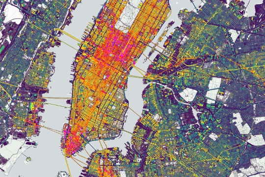
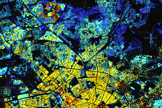
Map of material stocks in buildings and infrastructure across CONUS at a spatial resolution of 10m.

Vegetation Dynamics, Crete

Revisiting the Past: Replicability of a Historic Long-Term Vegetation Dynamics Assessment in the Era of Big Data Analytics

Mowing Events, Germany

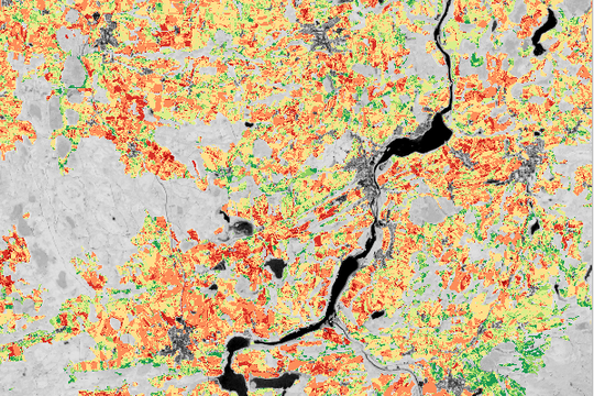
Mowing events derived from integrated Landsat 8 and Sentinel-2 time series at a spatial resolution of 10 m for the years 2017 - 2020.

Population, Germany

Gridded population map, Germany, based on building density, height and type (year: 2018).

Material Stocks, Austria/Germany

Map of material stocks in buildings and infrastructure across Germany and Austria at a spatial resolution of 10m. Includes federal statistics(year: 2018).

Building Height, Germany

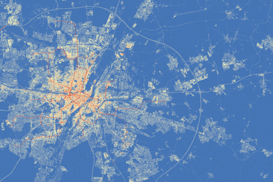
Map of building heights at a spatial resolution of 10m for the entire Germany (year: 2018).

Land Cover Fractions, Austria/Germany

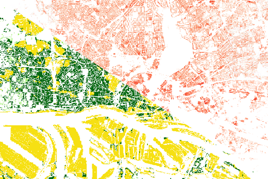
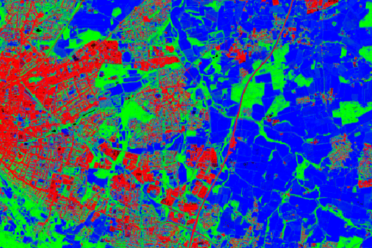
Fraction map of three land cover types (imperviousness, woody vegetation, non-woody vegetation) across Austria and Germany at 10m spatial resolution (year: 2018).

Cropping Practices, Türkiye

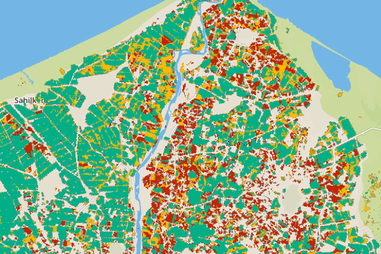
Map of five different cropping management practices across the entire Türkiye at 30m resolution (year: 2015).

Contact